Thank you! Your submission has been received!
Oops! Something went wrong while submitting the form.
Thank you! Your submission has been received!
Oops! Something went wrong while submitting the form.

John Deere iGrade™

Starting at

Starting at

New Equipment

Features

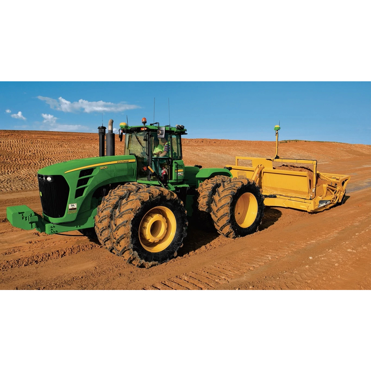
<div class="accordion-wrap"><div class="accordion2_component"><div class="accordion2_top"><div class="text-size-medium text-weight-bold">External Selective Control Valve (SCV)</div><div class="accordion2_icon w-embed"><svg width="100%" height="100%" viewBox="0 0 32 32" fill="none" xmlns="http://www.w3.org/2000/svg"><path d="M25.3333 15.667V16.3336C25.3333 16.7018 25.0349 17.0003 24.6667 17.0003H17V24.667C17 25.0351 16.7015 25.3336 16.3333 25.3336H15.6667C15.2985 25.3336 15 25.0351 15 24.667V17.0003H7.3333C6.96511 17.0003 6.66663 16.7018 6.66663 16.3336V15.667C6.66663 15.2988 6.96511 15.0003 7.3333 15.0003H15V7.33365C15 6.96546 15.2985 6.66699 15.6667 6.66699H16.3333C16.7015 6.66699 17 6.96546 17 7.33365V15.0003H24.6667C25.0349 15.0003 25.3333 15.2988 25.3333 15.667Z" fill="currentColor"></path></svg></div></div><div style="width: 1118px; height: 0px;" class="accordion2_bottom"><div class="margin-bottom margin-small"><div><p>The iGrade™ leveling system is compatible with various tractors using an external SCV and switch. An external SCV kit is available, including an open or closed center valve, SCV switch, bracket, and harness. The kit enables automatic scraper blade control, enhancing efficiency.</p><img src="https://johndeere.widen.net/content/zamx0pozt2/png/external_scv.png" alt="Studio view of a black external Selective Control Valve (SCV) for tractors" loading="lazy"></div></div></div></div><div class="accordion2_component"><div class="accordion2_top"><div class="text-size-medium text-weight-bold">Spend More Time Operating</div><div class="accordion2_icon w-embed"><svg width="100%" height="100%" viewBox="0 0 32 32" fill="none" xmlns="http://www.w3.org/2000/svg"><path d="M25.3333 15.667V16.3336C25.3333 16.7018 25.0349 17.0003 24.6667 17.0003H17V24.667C17 25.0351 16.7015 25.3336 16.3333 25.3336H15.6667C15.2985 25.3336 15 25.0351 15 24.667V17.0003H7.3333C6.96511 17.0003 6.66663 16.7018 6.66663 16.3336V15.667C6.66663 15.2988 6.96511 15.0003 7.3333 15.0003H15V7.33365C15 6.96546 15.2985 6.66699 15.6667 6.66699H16.3333C16.7015 6.66699 17 6.96546 17 7.33365V15.0003H24.6667C25.0349 15.0003 25.3333 15.2988 25.3333 15.667Z" fill="currentColor"></path></svg></div></div><div style="width: 1118px; height: 0px;" class="accordion2_bottom"><div class="margin-bottom margin-small"><div><p>The iGrade™ leveling system uses GPS technology to manage water up to 1.2 miles (2 km) from an RTK base station, unaffected by dust, wind, or nighttime conditions. While it may deliver sub-inch grading, vertical accuracy can vary by up to ±2 in. (5 cm) due to environmental factors.</p><img src="https://johndeere.widen.net/content/w0h9ht03ag/png/r4d004863-632x384.png" alt="Tractor pulls scraper in field" loading="lazy"></div></div></div></div><div class="accordion2_component"><div class="accordion2_top"><div class="text-size-medium text-weight-bold">Minimize Earthmoving Costs With Cut-Fill Maps</div><div class="accordion2_icon w-embed"><svg width="100%" height="100%" viewBox="0 0 32 32" fill="none" xmlns="http://www.w3.org/2000/svg"><path d="M25.3333 15.667V16.3336C25.3333 16.7018 25.0349 17.0003 24.6667 17.0003H17V24.667C17 25.0351 16.7015 25.3336 16.3333 25.3336H15.6667C15.2985 25.3336 15 25.0351 15 24.667V17.0003H7.3333C6.96511 17.0003 6.66663 16.7018 6.66663 16.3336V15.667C6.66663 15.2988 6.96511 15.0003 7.3333 15.0003H15V7.33365C15 6.96546 15.2985 6.66699 15.6667 6.66699H16.3333C16.7015 6.66699 17 6.96546 17 7.33365V15.0003H24.6667C25.0349 15.0003 25.3333 15.2988 25.3333 15.667Z" fill="currentColor"></path></svg></div></div><div style="width: 1118px; height: 0px;" class="accordion2_bottom"><div class="margin-bottom margin-small"><div><p>Cut-fill maps help shape land efficiently by minimizing earth movement and supporting best-fit or multi-fit designs for leveling and drainage. The iGrade™ leveling system provides access to these maps when paired with compatible software and hardware.</p><img src="https://johndeere.widen.net/content/8d0qm7xmad/png/cut-fill_map.png" alt="Rear left view of a tractor pulling a scraper with iGrade™ leveling capabilities across a dirt lot" loading="lazy"></div></div></div></div></div>
Question text goes here

Lorem ipsum dolor sit amet, consectetur adipiscing elit. Suspendisse varius enim in eros elementum tristique. Duis cursus, mi quis viverra ornare, eros dolor interdum nulla, ut commodo diam libero vitae erat. Aenean faucibus nibh et justo cursus id rutrum lorem imperdiet. Nunc ut sem vitae risus tristique posuere.

Specifications

<div class="accordion-wrap"></div>